Geochicas: Helping Women Find their Place on the Map


From over 4,000,000 collaborators in the world largest crowdsourced database, only 2–5% are women. We are talking about OpenStreetMap, also called the Wikipedia of maps. It is unfortunately not an uncommon problem, in Wikipedia the situation is also dramatic, the contributors in 2018 were 90% males, 9% women and 1% others. Why is it so important to have a diverse group of people creating data? The answer is simple, having data added by one specific group create bias in the information. By having diversity in the collaborators, the projects will better represent the information—this goes for any encyclopedia, map, or database.
Geochicas is a network for women in OpenStreetMap with over 200 participants representing more than 22 countries worldwide. This initiative started during the State of the Map Latam conference in Sao Paulo, Brazil in 2016 and we focus on increasing the participation of women in the geospatial and technology spaces. We also analyze how women are represented in such spaces and the role of women in terms of the decision making structures of the mapping community.
At Geochicas, we believe that real-life interactions are needed now more than ever, so finding ourselves in events helps us to create greater bonds with other women. We believe in the self-teaching process, and reflecting not only as contributors of a community but also as individuals that were brought together for one particular goal: not to give up spaces where we can have an impact not only for us but for other many women. Our projects take place within the OSM and Geochicas communities and are defined by individual interests linked to a local context or by the community at the local level.
Through these initiatives the Geochicas try to link and scale whenever possible:
- To create a useful analysis for greater gender equality in the geospatial data communities.
- To generate useful information for women, whether they are direct users of the data or beneficiaries of the planning or policies that it allows, or that sensitizes gender inequalities in different levels.
- To replicate and expand projects when relevant to more countries where Geochicas act.
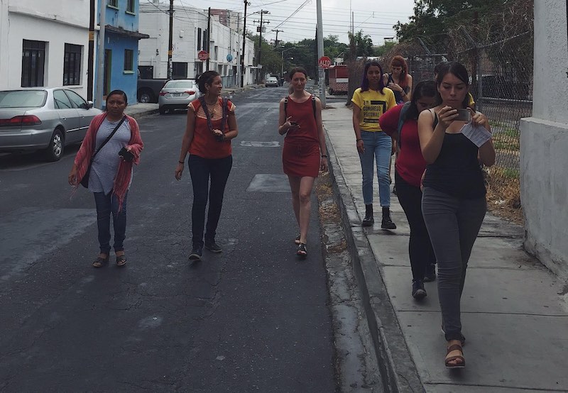
Currently, there are many projects led by Geochicas at the local, regional and global levels. One of those projects, The Streets of Women (Las Calles de las Mujeres), was formed around International Women's Day in 2018. It is intended to make survey information about passages, streets, avenues, roads that are named after a woman also linking it to Wikipedia to check if there is a biography written about her.
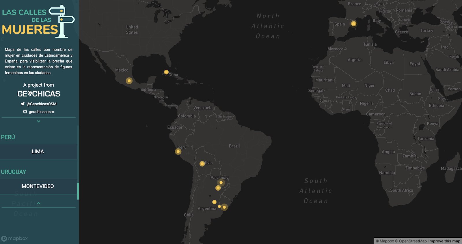 Las Calles de las Mujeres surveys passages, streets, avenues, and roads that are named after women
We also host regional editathon+mapathons as an initiative to create and edit women's oriented health and social facilities and to re-tag many amenities that needed a gender-focused characteristic, such as abortion clinics (in countries where is legal) or gender violence attention centers.
Geochicas and Mapillary
Post-earthquake project in Mexico with Humanitarian OpenStreetMap Team
After the Oaxaca earthquakes in 2017, we decided to document the recovery of the southern states affected. One of our goals in Geochicas is to have more women leading projects, so we prepared a recently graduated young woman to be responsible for the field data collection.
The field work consisted of conducting interviews with different community leaders and generating documentation through photomapping. The street-level imagery helps organizations review the before and after in those areas, and have images witnessing the application of the resources in the infrastructure recovery. In total, 18 municipalities and 11 localities in the State of Oaxaca were visited. More than 10 interviews were carried out with people affected by the earthquake, more than 900 amenities were added and more than 166,000 photographs were uploaded to Mapillary.
A Mapillary sequence from Oaxaca following the 2017 earthquake
CallesVioletas
CallesVioletas (Purple streets in Spanish) is a methodology of qualitative and perceptive evaluation by women of the environment in which they move, from their gender perspective. It uses audio-mapping and photo-mapping to synthesize free and reflective expression about feelings regarding security along a path defined by them in their city. The audios registered with OSMand are georeferenced, along with the images taken with Mapillary, with the objective of forming a diagnostic material easy to visualize for public action in coordination with authorities.
A Mapillary sequence from the CallesVioletas project
How to support Geochicas
We have two types of contributors:
- Women and any who perceives herself as women. Please join the Telegram Group GeochicasOSM and introduce yourself. If any of the projects are of your interest please raise your hand and start participating.
- Men are welcome to contact us via Twitter or email to participate giving training in our webinars, being a Mentor or supporting with your knowledge on a specific topic.
Geochicas is more than two years old now, and we still can’t believe how fast the time has been passing by. Since our early stages, we have conquered a lot as a community and achieved much with only the help of our supporters and sponsors. It has been an amazing ride and we couldn’t do it without companies like Mapillary. A special thanks to Mapillary’s team for believing and supporting our initiative!
/Selene, Miriam, and Céline