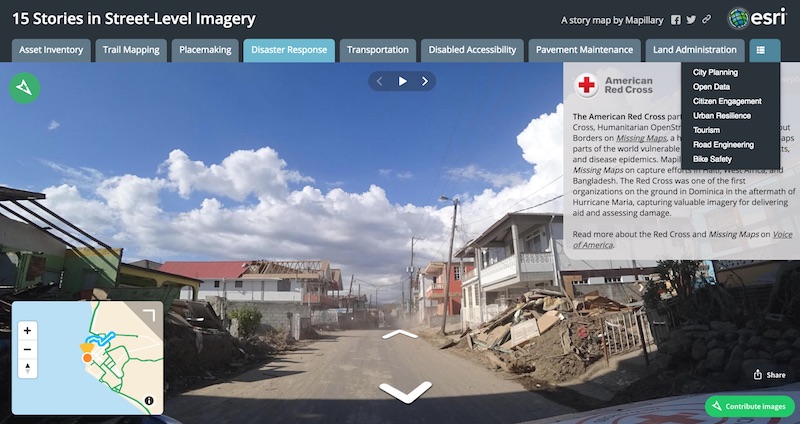
GIS Day Special: 15 Stories in Street-Level Imagery
We're celebrating GIS day with 15 customer stories told with street-level imagery—from asset inventories and city planning to disaster response and open data initiatives. Also, we're involved in a number of events!
GIS day is here again! This year we celebrate by highlighting 15 of our favorite GIS customer stories across a range of categories in an Esri Story Map—from asset inventories and city planning to disaster response and open data initiatives. (Learn how to make your own Story Map with Mapillary here).
Here’s a round-up of events we’re supporting this year:
- The City of Johns Creek, GA, is launching a #CompleteTheMap campaign, empowering residents to capture their own street-level imagery for street sign collection
Los Angeles County GIS Day: our friends at Argo Labs will be speaking at 1:30 pm PT about water management and turf market transformation (here’s a sneak preview of their presentation)
We’ll have a booth at Stanford GIS Day
The University of Tennessee, Knoxville, will be showing off Mapillary imagery from their #MapillaryPhotoWalk at the UTK GIS Day (please support their crowdfunding campaign to raise money for four action cameras for maintaining fresh 360° views of the campus!)
Catch the presentation on Humanitarian OpenStreetMap and Asset Mapping at the Ohio University GIS Day
And because there’s always too many GIS festivities for just a single day, if you’re in the NYC area come hear us speak about maps for mobility at the American Geographical Society’s Geography 2050 event on November 16–17 and at Maps Camp 2017 on November 18.
Happy GIS Day!
/Janine

